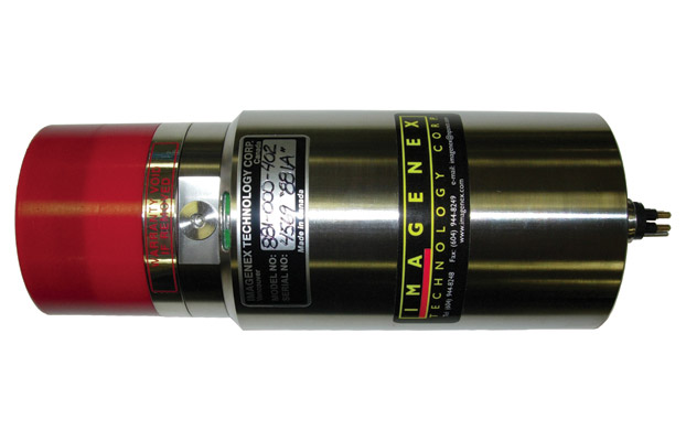
881A 6000 m Imaging
DIGITAL MULTI-FREQUENCY IMAGING SONAR
Now with Multi-frequency Sonar, operators can generate highly detailed full-scale images with just one unit. The 881A is a programmable multi-frequency digital imaging sonar that you can operate using default frequency settings or customize the configurations for your own situation. High performance, lower cost, low power and simple set-up and installation, make this sonar perfect for the largest ROV’s to the smallest inspection ROV’s, plus AUV or UUV applications.

Underwater Hardware Specifications
Frequency
310 kHz, 675 kHz, or 1 MHz (default settings)
-Other frequencies can be selected through programmable software configurations
(Tunable from 280 kHz to 1.1 MHz in 5 kHz steps)
Transducer
Imaging type, fluid compensated
Transducer Beam Width
310 kHz: 4° x 40°
675 kHz: 1.8° x 20°
1 MHz: 0.9° x 10°
Range Resolution
1 m – 4 m: 2 mm (0.08”)
5 m & up: 10 mm (0.4”)
Min. Detectable Range
150 mm (6”)
Max. Operating Depth
6000 m
Max. Cable Length
1000 m on typical twisted shielded pair (RS-485)
Interface
RS-485 serial interface @ 115.2 kbps (or optional RS-232)
Connector
Side mounted, four conductor, wet mateable (Subconn MCBH4M-Ti)
Optional right angle or end mount connector
Power Supply
20 – 36 VDC at less than 5 Watts
Dimensions
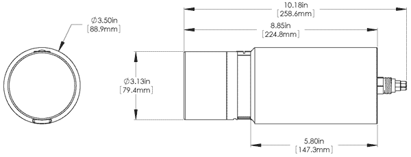
88.9 mm (3.5”) diameter x 225 mm (8.85”) length
Weight in Air
~3.1 kg (6.8 lbs)
Weight in Water
~1.8 kg (3.9 lbs)
Materials
Titanium & Polyurethane
Finish
None
Software Specifications
Win881A.exe, Win881AL.exe
v3.10, v1.0.7.0
Windows™ Operating System
Windows™ XP, Vista, 7, 8, 10
Modes
Sector, Polar and Side Scan
Range Scales
1 m, 2 m, 3 m, 4 m, 5 m, 10 m, 20 m, 30 m, 40 m,
50 m, 60 m, 80 m, 100 m, 150 m, 200 m
Train Angles
Continuous rotation, 3° increments
Sector Size
Sector Mode: 0° – 180°, 3° increments
Polar Mode: 0° – 357°, 3° increments, or Continuous rotation
Step Sizes
Slow (0.3°), Medium (0.6°), Fast (0.9°), Faster (1.2°), Fastest (2.4°)
Grid Types
Polar and rectangular
File Format
(filename).81a
Recommended Minimum Computer Requirements
100 MHz Pentium
16 MB RAM
1 GB Hard Disk
800 x 600 x 256 colour graphics
Ordering Information
6000 m Unit
881-000-402
RS-232
Option -006
End mount connector
Option -009
Right angle connector
Option -010
Interface source code in "C" (TEST881A.C)
Option -018

